Data Extraction AI For Old Construction Drawings
March 2025
An AI agent for generating site plans based on satellite images. AI land data collection: automatic aggregation of government records, satellite imagery, and topographic elevation data.
In the U.S., obtaining a topographic site plan is a labor-intensive, expensive, and extremely slow process. Surveyors must physically visit the site, perform measurements, and then prepare the final drawing over several weeks. This can cost up to $18,000 and take more than a month.
Our client’s goal was to make getting a site plan as easy as opening a web page. They approached us to automate the entire process — from data collection to generating the final plan.
Based on satellite maps and open government data, we developed a web platform that automatically collects all the necessary information about a plot: boundaries, topography, buildings, even sun exposure and wind conditions. After gathering this information, the platform generates a PDF drawing ready to be shared with architects or local authorities.
The first step in the business process is data collection and aggregation. To create a plan, it is necessary to know:
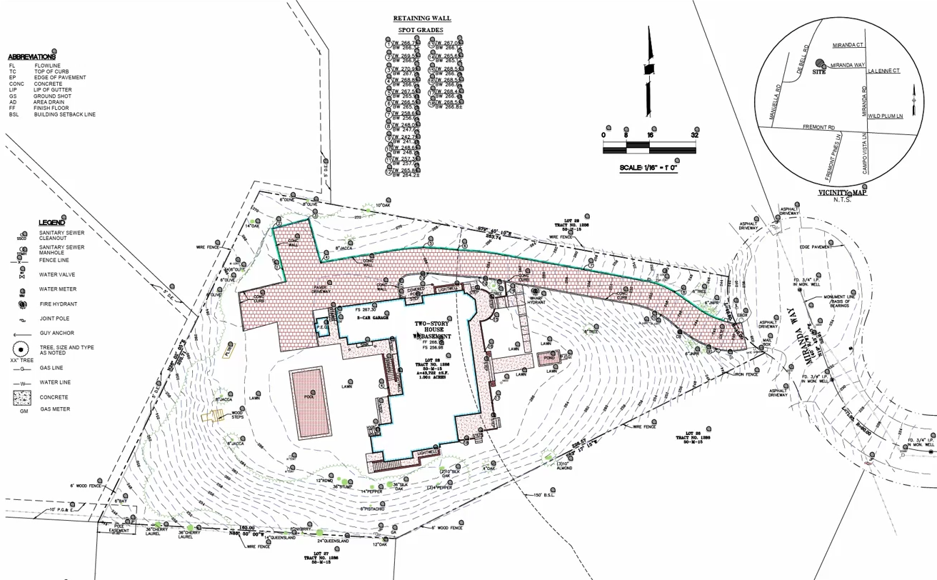
Plot boundaries are retrieved via APIs from sources similar to a land registry. Using the GPXZ.io service, the system obtains elevation and terrain data (topography).
Next, based on satellite images, the actual site plan is generated with buildings and objects georeferenced to coordinates.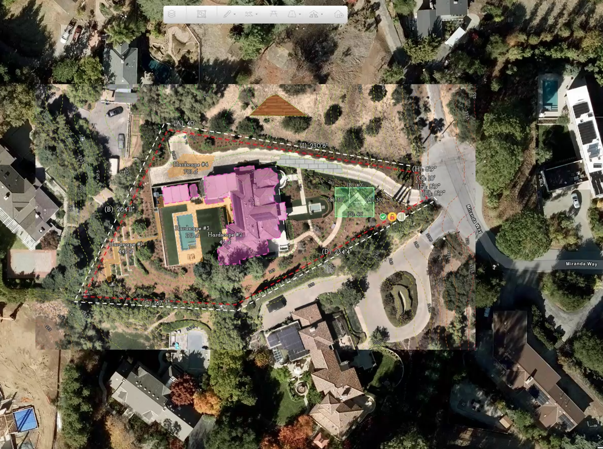
Additional data such as solar exposure and wind conditions are optional and integrated from public registries.
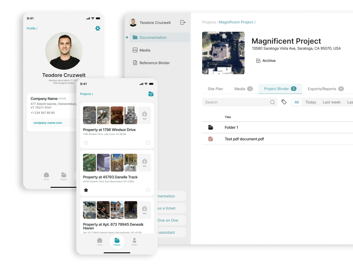
On the client side, we developed a fully functional web application that allows users to:
We also integrated a “pseudo-CAD” module — designed to mimic the UX of tools like AutoCAD or VectorWorks. It supports contour drawing, parameter input, area measurements, and saving modifications.
An important part of the system is the reporting module, which allows users to:
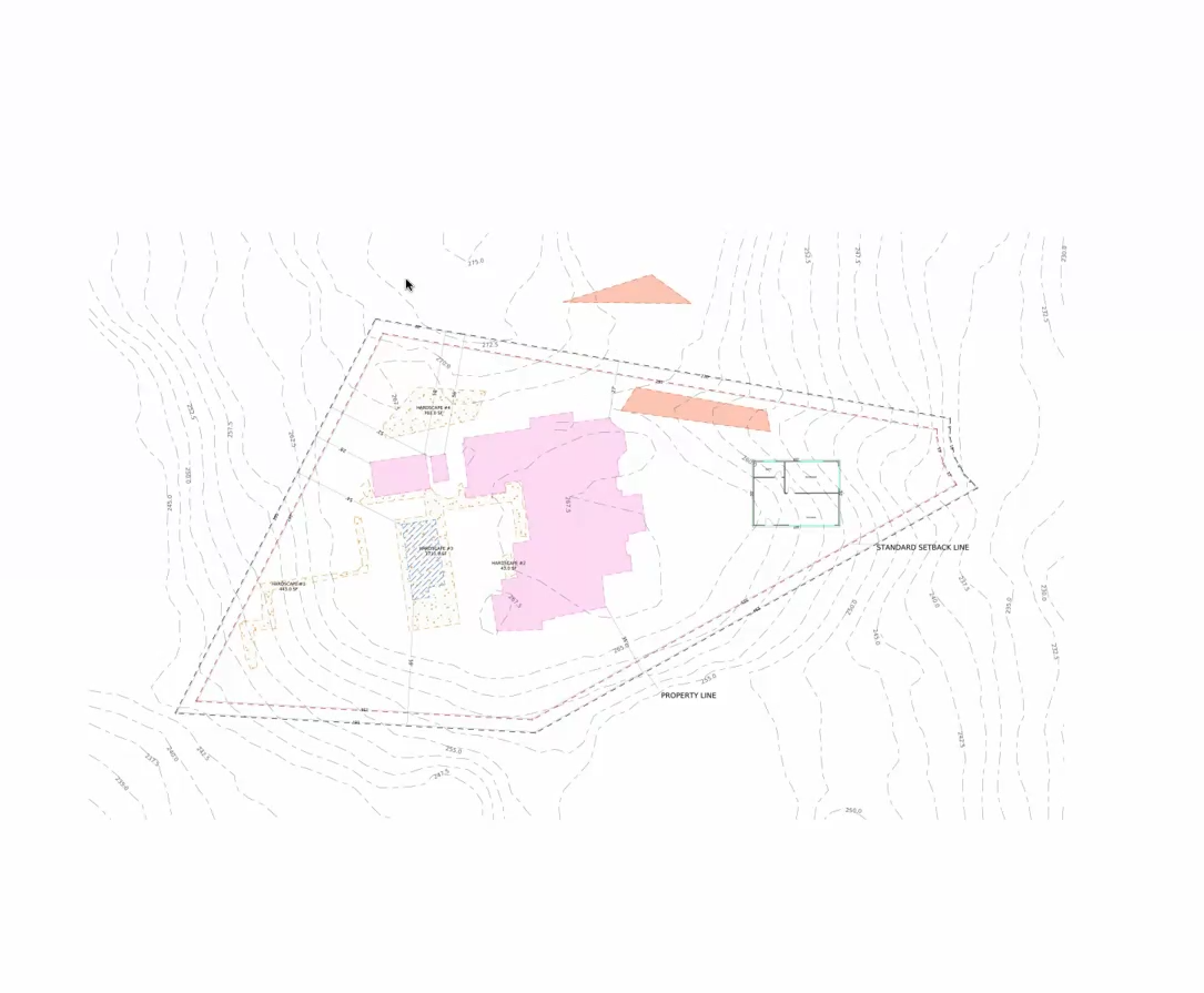
The platform can also generate a 3D representation of the site, with features like:
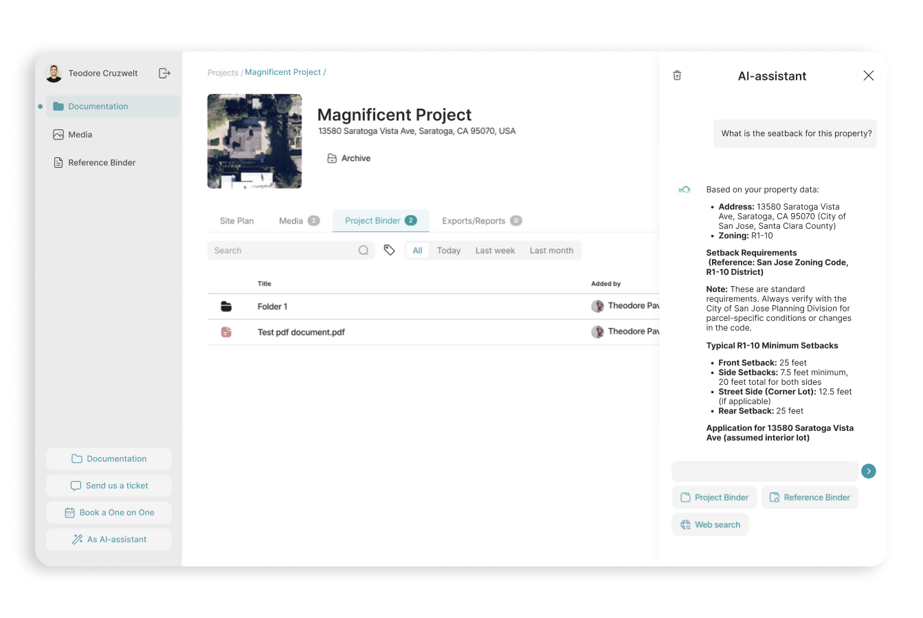
The core feature of the platform is an intelligent assistant built on RAG architecture and OpenAI models. It analyzes uploaded documents and images for each project, takes into account administrative regulations applicable to the region, and answers questions related to the specific site.
This way, users receive fast and accurate recommendations without the need to consult multiple specialists. Construction is a complex field: different types of buildings are subject to different standards and tolerances, which may also vary from state to state.
For field staff working on real sites, we have developed a mobile application. It allows them to take photos on-site, add comments, and automatically upload data to the project.
All information is synchronized with the web platform and immediately becomes available to both the AI assistant and the user.
The platform integrates with Stripe: creating a new project requires payment ($240 per project). The platform operates as a full-fledged SaaS service.
We helped the client produce the first automated land site plans that are comparable in quality to professional surveyors’ work. But instead of taking weeks, the process takes only minutes. And instead of costing tens of thousands of dollars, each plan costs just a fraction of that.
In the future, the system will evolve into a full-fledged design tool: users will not only be able to generate up-to-date site plans but also design buildings on them with automatic compliance checks against building regulations.
Do you want to know the total cost of development and realization of the project? Tell us about your requirements, our specialists will contact you as soon as possible.